Tag: GPS NavFunPro
Overview :
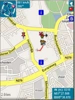
NavFunPro (the pro version of NavFun) is the most universal Google-Maps tool that gives you all the goodies of Google Maps and Google Earth. You can connect your bluetooth GPS or use the mobile''''s built in GPS. Then NavFunPro turns your mobile into an all-terrain navigation/gps tool. All your tracks are uploaded to internet.
Features
•Always use up-to-date maps by using Google Maps, and Google Earth
•Supports bluetooth GPS and built in GPS (JSR 179)
•Find addresses, businesses, weather conditions, city-info, other buddies
•Define waypoints
•Dashboard with compass, speed, altitude, coordinates, and distance to target
•Altitude graph with browse option
•Load GPX track-files from your mobile's file-system (for example flash card), show the track on your mobile's map, and let your mobile guide you through the track
•Store your track as GPX file to your mobile's file-system. After that you can review your track on your PC (using for example Google Earth)
•Review/export your tracks
•See and chat with your buddies that use NavFunPro or Tracky
•You can disable Google maps to minimize internet-data.
•Also works on mobiles without internet. In that case tracks are not uploaded and maps are blank
•Also work without GPS. In that case you can browse maps and use the find-feature
The demo version contains all features, but you have to restart it each 30 minutes. After 10 days the demo is over. NavFunPro is a Java program. Java is not available on older Blackberry devices. Runs on most new Blackberry devices. Please try the free trial before buying.
Model:
Blackberry 83XX Series (320*240) Curve Devices Models: 8300, 8310, 8320, 8330/Blackberry 87XX Series (320*240) Devices Models: 8700c, 8700r, 8700f, 8700g, 8703e, 8707, 8707g, 8707v .etc /Blackberry 88XX Series (320*240) Devices Models: 8800, 8820, 8830 .etc
|
